
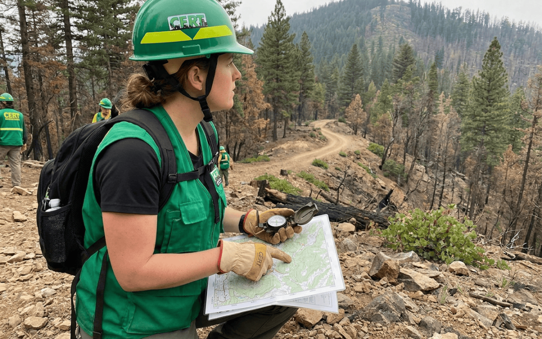
Search and Rescue Navigation: Map and Compass Skills for CERT Volunteers
When disaster strikes and traditional communication systems fail, Community Emergency Response Team (CERT) volunteers become the eyes and ears of emergency responders. Among the many skills these dedicated volunteers must master, navigation stands out as absolutely critical. While GPS technology has revolutionized how we find our way, nothing beats the reliability of traditional map and compass skills when technology fails or batteries die during extended emergency operations.
For CERT volunteers involved in search and rescue operations, understanding navigation fundamentals isn’t just helpful—it’s potentially life-saving. Whether you’re helping coordinate evacuations, conducting damage assessments, or participating in search operations, your ability to navigate accurately and communicate locations effectively can make the difference between success and failure in emergency situations.
Why Traditional Navigation Skills Matter for CERT Teams
In our smartphone-dependent world, you might wonder why CERT volunteers need to learn “old-fashioned” navigation techniques. The reality is that disasters often create the perfect storm of conditions that render electronic navigation unreliable or impossible.
During major emergencies, cell towers frequently lose power or become overloaded, GPS devices run out of battery power, and electromagnetic interference can disrupt satellite signals. Hurricane Katrina, the 2011 Japan earthquake, and countless other disasters have demonstrated that when communities need help most, technology often fails first.
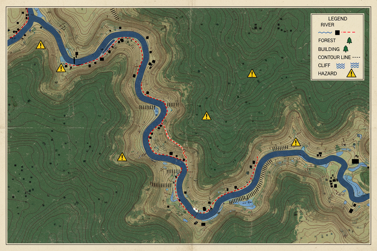
Traditional map and compass navigation provides CERT volunteers with a backup system that works regardless of power outages, network failures, or equipment damage. These skills also enhance your understanding of terrain, help you plan more efficient routes, and enable you to communicate precise locations to other team members and emergency responders.
Essential Map Reading Skills for Emergency Response
Effective navigation begins with understanding how to read and interpret topographic maps. Unlike the simplified maps we use for everyday navigation, topographic maps contain detailed information about terrain features, elevation changes, and potential hazards that can significantly impact search and rescue operations.
Learning to read contour lines is perhaps the most important map skill for CERT volunteers. These curved lines connect points of equal elevation, creating a two-dimensional representation of three-dimensional terrain. Closely spaced contour lines indicate steep slopes that might be difficult to traverse, especially when carrying equipment or assisting injured persons. Widely spaced lines show gentle slopes that typically offer easier travel routes.
Understanding map symbols and legends allows you to identify crucial features like water sources, roads, buildings, and potential hazards. Different map series use varying symbol systems, so always check the legend before heading into the field. Pay special attention to symbols indicating cliffs, marshes, dense vegetation, and other obstacles that could impede movement or create safety concerns.
Scale interpretation helps you estimate distances and travel times accurately. Most USGS topographic maps use a 1:24,000 scale, meaning one inch on the map represents 24,000 inches (or 2,000 feet) on the ground. Practice measuring distances using the map’s scale bar, and learn to estimate walking times based on terrain difficulty and your team’s capabilities.
Compass Fundamentals Every CERT Volunteer Should Know
A quality compass serves as your primary navigation tool when electronic devices fail. Understanding compass basics starts with recognizing the difference between magnetic north and true north. Magnetic declination—the angular difference between these two norths—varies by geographic location and changes slightly over time.
For accurate navigation, you must adjust for magnetic declination in your area. This information appears on topographic maps, typically in the margin notes. Some compasses allow you to set declination adjustment, automatically correcting for this difference. If your compass lacks this feature, you’ll need to add or subtract the declination value when taking or following bearings.
Taking accurate bearings requires steady hands and careful attention to detail. Hold your compass level and away from metal objects that might interfere with the needle. Point the direction-of-travel arrow toward your intended destination, then rotate the compass housing until the magnetic needle aligns with the orienting arrow. The bearing appears at the index line on the compass housing.
Following a bearing in the field involves more than simply walking toward the compass needle. Identify intermediate landmarks along your intended route, then navigate from point to point rather than constantly checking your compass. This technique, called “aiming off,” helps maintain accuracy while allowing for natural variations in terrain and obstacles.
Triangulation Techniques for Precise Location Finding
When you need to determine your exact position or locate specific points for search coordination, triangulation provides a reliable method using map and compass together. This technique involves taking bearings to two or more known landmarks, then plotting these lines on your map to find where they intersect.
Start by identifying at least two prominent landmarks visible from your position that also appear on your map. Mountain peaks, radio towers, and distinctive buildings work well for this purpose. Take careful compass bearings to each landmark, adjusting for magnetic declination if necessary.
Transfer these bearings to your map using a straight edge or the compass baseplate. Draw lines from each landmark back toward your approximate position using the reciprocal bearing (add or subtract 180 degrees from your original bearing). Your location lies where these lines intersect on the map.
For increased accuracy, take bearings to a third landmark when possible. Three lines should intersect at a single point, but in practice, you’ll often see a small triangle where the lines meet. Your actual position lies somewhere within this “triangle of error,” with the size indicating your measurement precision.
Route Planning and Waypoint Navigation
Effective search and rescue operations require careful route planning that considers terrain challenges, safety factors, and team capabilities. Before departing, study your assigned area thoroughly, identifying potential hazards, escape routes, and rally points where team members can regroup if separated.
Break longer routes into manageable segments by selecting intermediate waypoints—distinctive terrain features or landmarks that serve as navigation checkpoints. Choose waypoints that are easily identifiable from a distance and appear clearly on your map. Avoid selecting features that might be obscured by vegetation or difficult to distinguish from similar nearby objects.
Calculate estimated travel times between waypoints based on distance, elevation change, and terrain difficulty. A commonly used formula suggests 30 minutes per mile on level ground, plus an additional 30 minutes for every 1,000 feet of elevation gain. Adjust these estimates based on weather conditions, team fitness levels, and the weight of equipment being carried.
Always plan alternative routes in case your primary path becomes impassable due to hazards or obstacles discovered during the operation. Mark these backup routes on your map and brief all team members on the alternatives before beginning movement.
Communication and Coordination Using Grid References
Accurate position reporting forms the backbone of effective search and rescue coordination. CERT volunteers must be able to communicate their location and the locations of discovered hazards or victims using standardized grid reference systems that emergency responders understand.
Most topographic maps include Universal Transverse Mercator (UTM) grid lines that create a coordinate system for precise location reporting. UTM coordinates use meters rather than degrees, making distance calculations simpler and more intuitive for field operations. Learn to read and report UTM coordinates with appropriate precision for your mission requirements.
Practice converting between different coordinate systems, as various agencies may use different standards. Some emergency services prefer latitude and longitude coordinates, while others use local grid systems or landmark-based references. Familiarize yourself with the systems commonly used in your area and carry conversion tools or reference cards.
When reporting locations via radio, use clear, standardized communication protocols. Spell out coordinates using the phonetic alphabet, repeat critical information, and confirm that the receiving station has copied your transmission accurately. Remember that poor radio conditions during emergencies can lead to miscommunication, so clarity and redundancy are essential.
Practical Training Exercises for Skill Development
Mastering navigation skills requires hands-on practice in varied terrain and weather conditions. Start with simple exercises in familiar areas, gradually progressing to more challenging scenarios that simulate emergency conditions.
Begin with map and compass orientation exercises in local parks or open spaces. Practice taking bearings to visible landmarks, then check your accuracy by walking to these points and measuring the actual distance. This builds confidence in your equipment and techniques while revealing common sources of error.
Progress to route-finding exercises where you navigate between predetermined waypoints using only map and compass. Have teammates create courses for each other, including both straightforward legs and more complex routes that require detours around obstacles or hazards.
Conduct night navigation training to prepare for low-visibility conditions common during emergency operations. Use red-filtered flashlights to preserve night vision while reading maps and compasses. Practice these skills regularly, as navigation becomes significantly more challenging in darkness.
Organize team exercises that combine navigation with other CERT skills like medical response or damage assessment. These integrated training scenarios help develop the multitasking abilities needed during actual emergency operations while reinforcing navigation fundamentals under realistic conditions.
Conclusion
Map and compass navigation skills represent fundamental competencies that every CERT volunteer should develop and maintain. While modern technology offers convenient navigation solutions, the reliability and independence of traditional techniques make them invaluable during emergency operations when electronic systems fail.
Regular practice and continued skill development ensure that you’ll be prepared to navigate effectively when your community needs you most. Remember that navigation skills deteriorate without use, so incorporate map and compass exercises into your regular CERT training routine.
The investment in mastering these traditional navigation techniques pays dividends in increased operational effectiveness, enhanced safety, and greater confidence during emergency response operations. When disaster strikes and technology fails, your map and compass skills may be the tools that help save lives and coordinate successful rescue operations.
Frequently Asked Questions
What type of compass is best for CERT volunteers?
A quality orienteering compass with adjustable declination, a clear baseplate, and degree markings works best for CERT operations. Look for compasses with luminous markings for low-light use and sturdy construction that can withstand field conditions.
How often should CERT volunteers practice navigation skills?
Navigation skills should be practiced at least monthly to maintain proficiency. Include map and compass exercises in regular CERT training sessions, and encourage volunteers to use these skills during recreational activities like hiking.
What maps should CERT teams use for their area?
USGS 7.5-minute topographic maps provide the most detailed terrain information for most areas. Your local emergency management office may also provide specialized maps showing evacuation routes, shelter locations, and other emergency-specific information.
Can smartphone apps replace traditional navigation skills?
While smartphone apps are useful supplements, they shouldn’t replace traditional skills. Electronic devices can fail due to battery depletion, signal loss, or damage during disasters. Map and compass skills provide essential backup capabilities.
How do weather conditions affect navigation accuracy?
Rain, snow, and extreme temperatures can affect compass accuracy and make map reading more difficult. Cold temperatures can make compass needles sluggish, while metal objects and electrical interference can cause deviation. Always account for these factors in your navigation planning.
What should CERT volunteers do if they become lost during an operation?
Stop immediately and avoid panic. Use the STOP acronym: Sit, Think, Observe, Plan. Try to retrace your route to the last known position, use triangulation to determine your location, or move to higher ground for better visibility and radio communication.